EPISODE 639 BARNEY DWAN 6: GOING UNDERGROUND IN IRELAND
alan skeoch
sept. 8, 2022
After disovering the ‘Dead Cow Legend’ was true I began to pay closer attention to
the stories Barney Dwan told. This episode 639 led to a major
adventure.
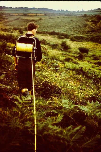
we were laying down a baseline across tiny fields close to the sea shore when Barney said
“Alan, how would you like together into the old mine?”
“Can that be done?”
“From the coast there are holes we can crawl through….I’ve done that many times.
“Dangerous?”
“I’ve got in and out and am still living.”
“Let’s do it?”
“When?”
“Tonight after work.”
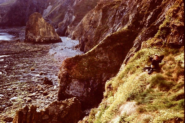
Look closely … See Barney Dwan ewatinf jut below the old adit.
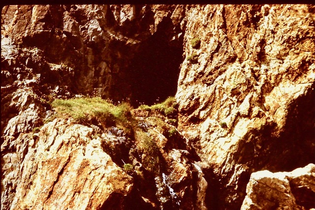
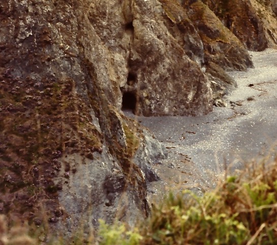
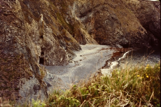
And so began my biggest Irish adventure. There was a hole halfway up the cliff face
not far from the knockmahon ruins. To get to the hole we could scale down from
the top of the cliff or scale up from the sea. The hole ws barely visible. A trickle of water
flowed out onto a grassy shelf. Hard to believe the hole was made by human beings.
An adit , designed to drain part of the mine or to get air into the mine. Perhaps both.
The hole was about three feet high. Occasionally higher. Most of our walk, however, we
were bent over. And we were careful. We had flashlights , candles and marches. Why candles?
To check the air quality. If the candle would light and stay lit, then there was no danger of
asphysiciation. If the candle would not light or suddenly went out then we should get
the hell out fast. No oxygen.
The walls of he passages were beautiful. Startling blue in place where the ore had not
been removed. Occasionally there were patches of pink
At one point the passage was blpcked by a roof collapse. Whoever dug this adit did not
use roof bolts or even timbers to hold up the roof. The blockage was a jumble of loose
rock and soft muddy detritus where water had percolated its way down and loosened
the ceiling enough for the roof to collapse.
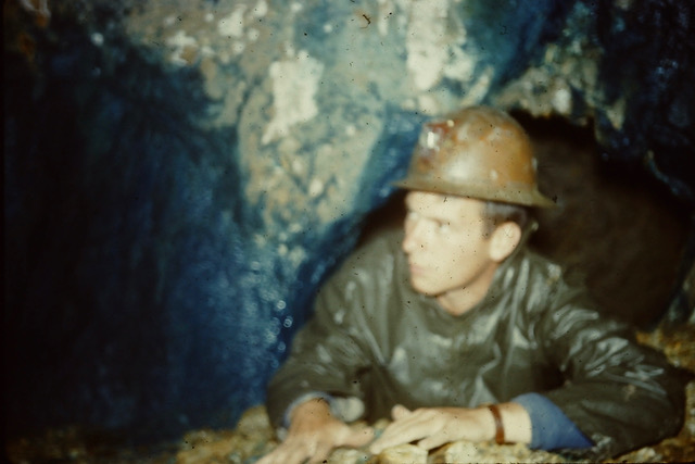
FortunatelyThere was a gap. Just enough crawl space for Barney and I to pull ourselves through using our elbows .
Barney led
and I followed. . The feeling of claustrophobia was almost
overwhelming . What if our bodies loosened more rock.? What if we got in and could not
get out? Did I tell Dr. Stam and John Hogan what we were doing? No, I did not. So
we were on our own. Now that was stupid. My only excuse is that I was 22 years old
an age when stupidity is commonplace.
The hole we crawled through using our elbows.
Once we got by the blockage we could almost standup again. Bent over though.
We crabbed our way along . I figured by then we were close to the
old mine ruins which were perhaps a hundred feet above us.
This was confirmed when we found a vertical shaft. Unsophisticated…almost natural.
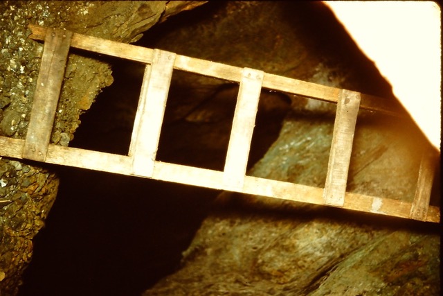
But not so. Barney Dwan had been in here before and found a wooden ladder that
he placed across the vertical shaft. Easy to cross. If he ladder was rotten we would only fall a few feet because
the shaft was filled with water. Crystal clear water. Dazzling in our flashlight beams.
Was this one of old ladders used by 19th citify minders to reach the ore far below?
The mine had been exploited a lot deeper than this adit. So far down that the
stopes were some distance under the ocean. Flooding was one reason the mine was closed
in 1879. The other reasons was that the ore petered out. There was a likelihood however
that there were seams of copper under the ocean that were never exploited and never would be.
Pumps were necessary to tentatively hold back the ocean. When the pumps were shut down
the ocean has perfectly preserved ever since the closure.
The main stopes were far below us. Bunmahon Miners reached these mineralized sections by climbing
down long wooden ladders. In the dark One foot at a time on wooden ladder rungs. In the dark.
Between 1840 and 1879 there were no miners lanterns attached to helmets. Indeed there were no
helmets.
(I will explain more about the 19th century Knochmahon miners in a subsequent episode. This episode is about
the adventureS that Barney and I had which triggered my curiosity about those 19th century miners
of Bunmahon. Where did they come from? Where did they go? What was their life like when they
lived here? Many came from the copper mines of Cornwall. Most of them migrated to various mines
in North America)
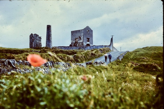
These are the ruins of the Knockmahon . Dr Stam and John Hogan are walking along
th e coast road now known as the “Copper Trail”, an UNESCO WORLD HERITAGE SITE.
The adit that Barney and I crawled through reached this ruin one shaft where the 19th century
miners had ladders to get them deep into the mine. Today the main underground
workings of this mine are perfectly preserved by tons and tons of sea water.
As I said, Crawling underground with Barney was a little risky. There was a feeling of claustrophobia
for sure but Barney’s cheerful presence reduced my fear and trepidation. Barney had been
here before and alone. He exuded confidence.
I did not tell our boss back in Canada, Dr. Norman Paterson, as i feared he would get his
underwear in a knot. Much later when I Told Dr. Stam and John Hogan about the underground
adventure they were both interested and amused. The oxidation on the adit walls…bright blue and pink,
confirmed that the site was worth the cost of our survey.
Miners drill holes for roof bolts to help prevent stopes and passageways from collapsing.
I do not remember any roof bolts in the abandoned Kn0ckmahon mine.
OTHER ADITS ON THE CLIFF FACE
I seem to remember entering the adit that is about 6 feet above the large ropeing on the ground.
.Thet adit led to the huge room inside with the slanted floor strewn with rocks.
THE I.R.A. HIDING PLACE, ACCORDING TO BARNEY’
(True or false? I would never know.)
“Alan, there is another tunnel you might like to explore just west of Bunmahon…a special place..”
“Why special?”
“Story is told that IRA members hid there back in the Time of the Troubles.”
“Time of the Troubles?”
“Back in the 1920’s when Ireland was at war with England…civil war.”
“Bad time?”
“Very bad….Republicans needed a hideout and I was told this other adit was perfect.”
“True or false?”
“I think true. The story says this other adit became a safe place. Not sure if it was ever discovered by
the Black and Tans.
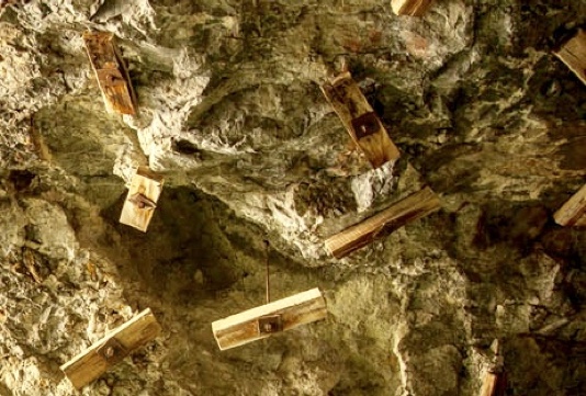
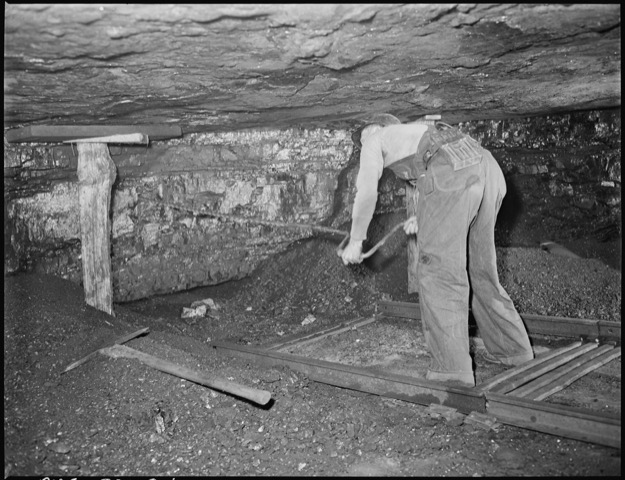
This picture gives a glimpse at what Bunmahon miners had to do using hand tools
and explosives. Mostly done in the dark with flickering light of candles and oil lamps. (The picture
is not from Bunmahon.9
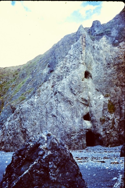
The adit was almost too easy to fnid. Two entrances, one straight from the beach.
Easy to get into the front part but dangerous as we discovered when we reached a high vaulted room
with a sharply tilted floor that angled far down to some kind of iron machine. We never got that
far. The tilted floor the big room was littered with large chunks of fractured rock. Covered in rubble
in other words. Directy opposite our entrance tunnel was another tunnel at the same level. A continuation.
We decided to traverse the rubble cluttered sharply angled floor. To traverse we had to step on lots
large ( baseball to pumpkin size ) rocks piled helter skelter in the room which was about 20 to 30 feet wide and
af hundred feet long. Memory could be wrong about size. Maybe the room had been carved as a chute for ore to tumble down to some
kind of mechanical crusher at the bottom. That is just speculation.
Our tour ended abruptly. We were part way across the angled floor….tordding on the rubble. Pushing some out of the way
to get better footing. Then the whoile pile of loose rock began to move. Us with it.. Not far…several feet and
then the rock slide stopped.
Barney and I retreated with great care. We did not want to end our lives buried in a pile of rock at the mouth of
a rock crusher if that was what the iron framed machine was at the bottom of the angled room.
Maybe that pile of loose rock was a good way to discourage visitors. maybe there was an easy way around the
jumble. We did not the time to find out. Too dangerous. I may have taken pictures but cannot find them.
PERHAPS YOU WANT TO GO UNDERGROUND AT BUNMAHON….THERE IS A WAY TO DO THAT.
IF you want to go underground you can do so..virtually. Just punch up the “Copper Coast Unesco Geopark (Ireland)”
A film has been made of the underground workings at Tankardstown which is the 19th century mine east of Bunmahon
and Knockmahon.
Copper mining reached its peak around in the area around Bunmahon in the mid 19th century when two major mines were worked by the Mining Company of Ireland.
The first, at Knockmahon reached peak production in 1840 when it was described as ‘the most important mining district in the empire’. It was soon unprofitable however, as the more easily reached copper was exhausted and reaching more would require digging more than an quarter of a mile deep and under the sea.
Knockmahon was abandoned and activity moved to nearby Tankardstown in the 1850s. Here mining thrived for a time but fluctuating and eventually just declining copper prices made it nonviable and the mine closed in 1879.
While conditions for workers in 19th century mining were harsh and the work dangerous, the period when the mines had highest employment – more than 2000 men – coincided with the years of the famine. So it’s easy to see how such a job would be greatly prized. When it all ended the Copper Coast miners mostly took their expertise and their families abroad, many to Copper Mountain in Butte, Montana and to mining areas in Wyoming.
The picture at the top is of a group of men on a cage during an abortive effort to revive the mine in 1906. Below that is pretty much all that remains today of the mine at Tankardstown.
Nowadays you can walk along a guided and signposted trail through the remains of the old mines. It’s a beautiful walk along a lovely stretch of coast even if you are not interested in the mines.
COPPER COAST UNESCO GLOBAL GEOPARK (Ireland)
“The Copper Coast tells the amazing story of the formation of Ireland”
Celebrating Earth Heritage
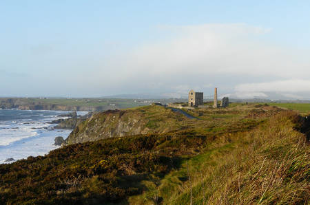 The Copper Coast UNESCO Global Geopark is located on the south east coast of Ireland, between Tramore and Dungarvan in County Waterford. To the north lie the Comeragh Mountains which reach a height of 750 m. The area is a relatively flat lying glacial outwash plain, much covered by glacial till and bog, with occasional spectacular erratics. Three roughly N-S rivers dissect the UNESCO Global Geopark and display excellent examples of glacial erosion and deposition (an excellent walk follows the Ann river starting at Annestown). The coast is spectacular with numerous sandy and rocky coves displaying sea stacks, arches and blow holes. It comprises some 25 kilometres of spectacular coastline consisting of scalloped beaches and coves buttressed and enclosed by rocky headlands.
The Copper Coast is an outdoor geology museum with a geological heritage that reflects the variety of environments under which the area has evolved over the last 460 million years. Sedimentary and volcanic rocks define a cross-section through the core of an Ordovician age island arc volcanic system (ca. 460-455 Ma) which extended along the south-eastern flank of the Iapetus Ocean. A fossil rich siltstone/limestone (c. 462-457Ma) marks a hiatus above which the sequence is dominated by felsic volcanic rocks, with intrusive equivalents interspersed with shales, some graptolitic. Spectacular columnar jointed rhyolite is well exposed at one locality. Semi-arid fluviatile sediments (ca. 370-360 Ma), now reddish brown coloured conglomerates, sandstones, siltstones and shales, rest with marked unconformity on the Ordovician. An enormous gap in geological time separates these sequences from those next exposed, unconsolidated tills, boulder clays and outwash sands and gravels of the Quaternary period (Pleistocene epoch) all deposited with very profound unconformity on the Ordovician and Devonian sequences.
Cross-sections of these rocks are exposed along the spectacular cliffs and are interpreted for the public at various points. For a brief introduction to these rocks, a stroll around the Geological Garden in Bunmahon will prove instructive. Copper was mined extensively in the area during the 19th century. The Geopark’s name is derived from this activity, and the Copper Coast icon is derived from the conserved remains of a mine complex on a high point of the cliffs. Panels there explain how the mine worked.
 The Copper Coast UNESCO Global Geopark is located on the south east coast of Ireland, between Tramore and Dungarvan in County Waterford. To the north lie the Comeragh Mountains which reach a height of 750 m. The area is a relatively flat lying glacial outwash plain, much covered by glacial till and bog, with occasional spectacular erratics. Three roughly N-S rivers dissect the UNESCO Global Geopark and display excellent examples of glacial erosion and deposition (an excellent walk follows the Ann river starting at Annestown). The coast is spectacular with numerous sandy and rocky coves displaying sea stacks, arches and blow holes. It comprises some 25 kilometres of spectacular coastline consisting of scalloped beaches and coves buttressed and enclosed by rocky headlands.